
Maps of Lake Tarpon
A very nice Bass Map was published by Mark Evans, of St Cloud
FL. Unfortunately, the contact information on the map is no longer valid
and new contact information cannot be found. Until it is found, you can
click on the above graphic and download the full resolution version. If
new contact info or sales outlets are found, I will no longer distribute the
full res version. This map
is not oriented with North at the top (US 19, on the lower left runs north-south).
The map below is oriented with North at the top.

Click on this map for a FREE high resolution copy (719K). It may be freely distributed for non-commercial purposes. It is intended for cruising and watersports enthurisasts, but not for navigation. There are relatively few navigational hazards on Lake Tarpon, usually just shallow water in some of the residential canals - however, hazards change with time and are not documented on any of these maps.
Please send me corrections and enhancements (at the email on the home page) for all to enjoy. The photo is from the Pinellas County Property Appraiser's office and the added information is copyright 1998 Paul Kempter.
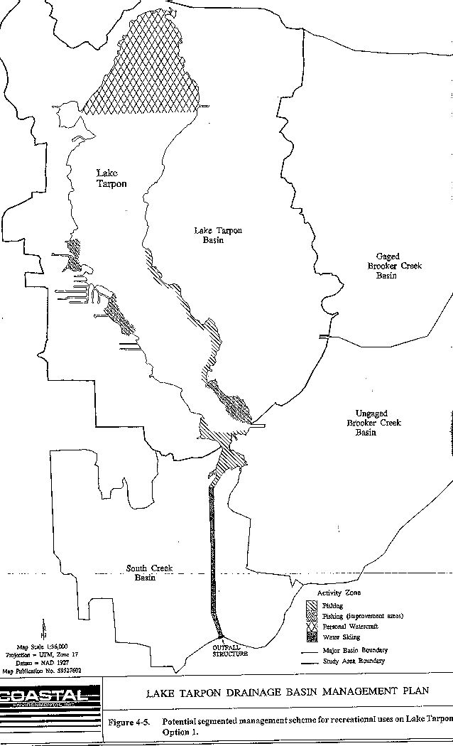
The left map shows a proposed segmented use plan for Lake Tarpon. It is one of several maps in the Lake Tarpon Management Plan (draft). Click on it for a full-resolution version (95K).
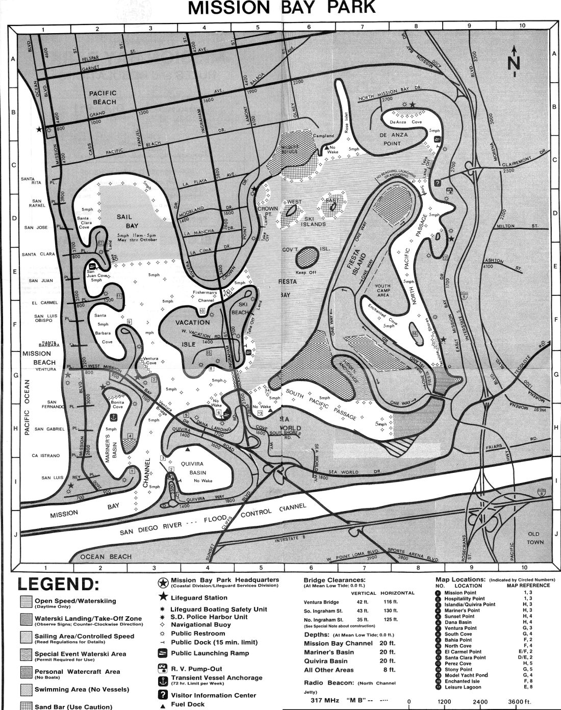
The right map shows how San Diego's very effective answer to crowded waterways - a well-defined segmented use scheme. Click on this photo for a full resolution version (455K). More information on user conflicts is on this page.
Back to the main page.
Please verify all information independently before taking action -
accuracy or completeness is not guaranteed. Do not use for navigation because not
all hazards are not obvious or documented.